Vancouver visitor guide
Plan Vancouver around the waterfront, park and market areas, with Canada Line and cruise arrival options.

Use Vancouver’s seawall as an orientation, then split the visit between a park day, a market or museum and one other neighborhood. Waterfront views can be worth the hotel price if you will be there when the light is good.
What to see
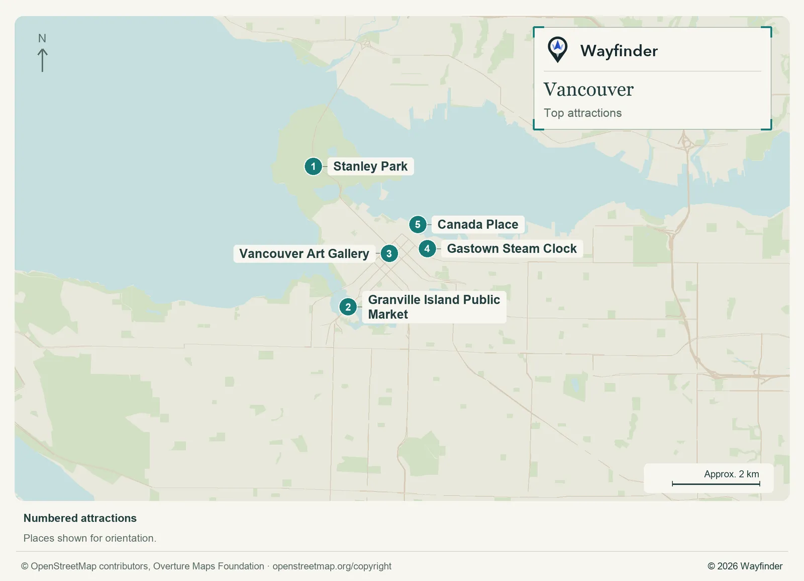
Map: Wayfinder. Map data © OpenStreetMap contributors, Overture Maps Foundation (OpenStreetMap copyright, Overture attribution).
Open attractions map (SVG, full detail)

- Stanley Park. Choose just one section and decide in advance how to return. Give weather and tide enough room if you are planning a waterfront visit. (City of Vancouver Stanley Park, checked November 19, 2026)
- Granville Island Public Market. Use the market as the food anchor and leave time for the surrounding studios or water. (Vancouver visitor information, checked November 20, 2026)
- Vancouver Art Gallery. Check the exhibition and use it for an indoor downtown block. (Vancouver Art Gallery, checked November 20, 2026)
- Gastown Steam Clock. Treat this as a landmark on the way through a few streets. Keep the rest of the visit about the neighborhood. (Vancouver visitor information, checked November 20, 2026)
- Canada Place. Use the promenade as a harbor reference and identify the assigned cruise entrance separately. (Vancouver visitor information, checked November 20, 2026)
Where to stay
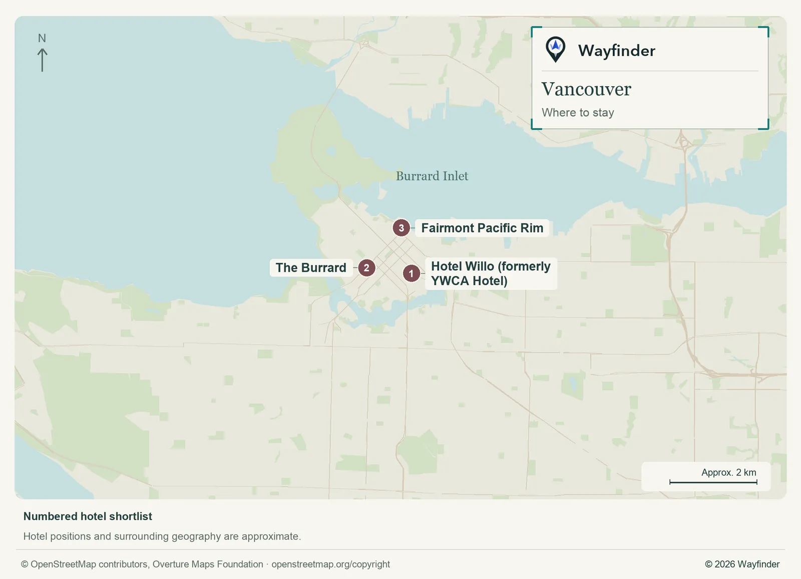
Map: Wayfinder. Map data © OpenStreetMap contributors, Overture Maps Foundation (OpenStreetMap copyright, Overture attribution).
Open hotels map (SVG, full detail)

- Hotel Willo (formerly YWCA Hotel) (Stadium district, value starting point). The stadium district is a practical budget base and makes downtown transit easy to reach. (Hotel Willo (formerly YWCA Hotel), checked November 19, 2026)
- The Burrard (West End edge, midrange candidate). The West End edge suits a trip oriented towards neighborhood dining and Stanley Park. (The Burrard, checked November 20, 2026)
- Fairmont Pacific Rim (Coal Harbour, splurge). Coal Harbour is useful for a waterfront splurge and time at the property between outings. (Fairmont Pacific Rim, checked November 20, 2026)
Getting in and around
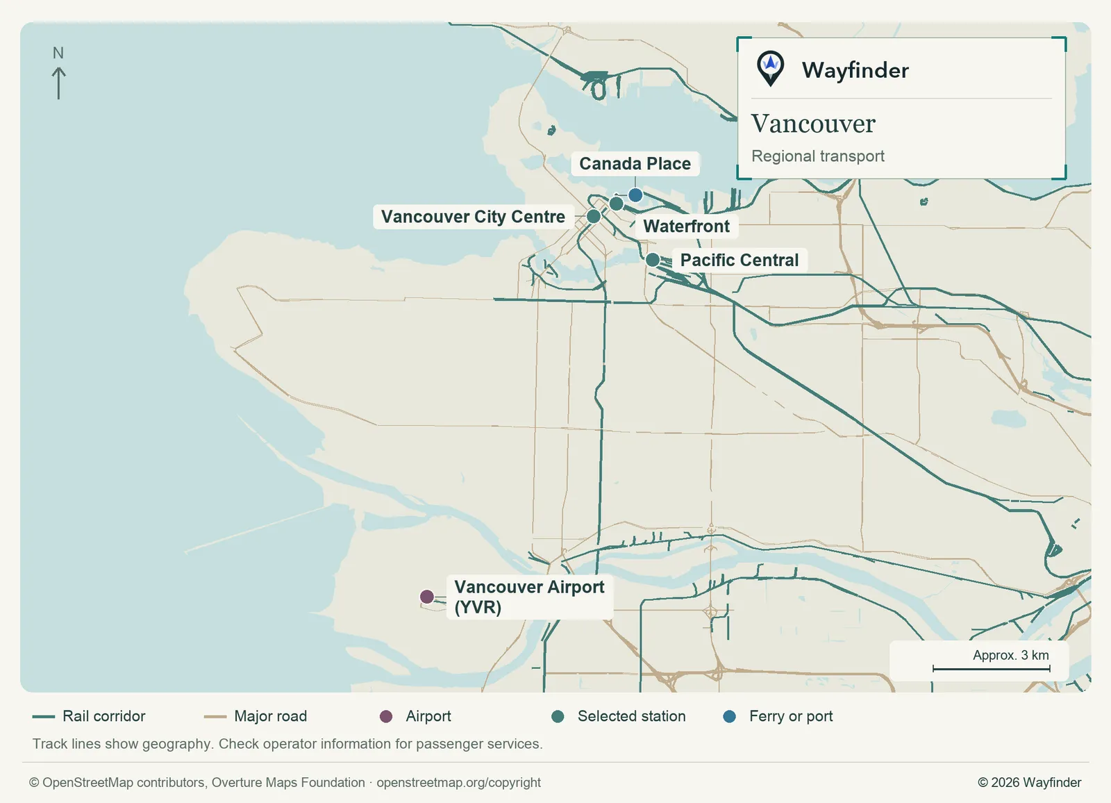
Map: Wayfinder. Map data © OpenStreetMap contributors, Overture Maps Foundation (OpenStreetMap copyright, Overture attribution).
Open regional transport map (SVG, full detail)

Canada Line connects YVR with central stations. Check the station and walk that best suit your address. Pacific Central is the intercity railway reference and serves a different purpose from Waterfront. For Granville Island, use the actual bus or ferry stop when comparing routes. (Airport or regional connections, checked November 19, 2026) (Local transport information, checked November 20, 2026)
How to use three days
Choose downtown and the harbor first, Stanley Park second and Granville Island third. If arriving by ship, keep your first outing within the waterfront area rather than taking luggage through a market or museum.
If you only have a day
For one day, pick a section of the seawall and leave time on either side of Stanley Park or Granville Island. A cruise arrival already puts you in the right area for a harbor outing. Use the onward line that fits the station or airport you actually need.
Common questions
Is the airport train useful for a cruise?
Waterfront is a useful reference, but check the route to the correct Canada Place cruise entrance and factor in luggage on the final leg.
How do I avoid overplanning Stanley Park?
Pick one section near the start or finish you prefer, then choose how you will return. Check the current route for any closed stretch. Use a separate day for Granville Island if the park will be the longest outing.
More on Wayfinder
- Vancouver Airport: US Preclearance, Connections and the Canada Line from Airline Ace
- Cruising from Vancouver: Canada Place, embarkation day and what to check for Alaska sailings from Cruise Champion
- A Night in Vancouver Before a Cruise or a Train: Canada Place or Pacific Central from Hotel Hacker
- Amtrak Cascades: Seattle to Vancouver by train, the border and booking from Railway Reviews
- Vancouver place profile from Bucketlist
Sources
- Vancouver visitor information, checked November 20, 2026.
- City of Vancouver Stanley Park, checked November 19, 2026.
- Vancouver Art Gallery, checked November 20, 2026.
- Hotel Willo (formerly YWCA Hotel), checked November 19, 2026.
- The Burrard, checked November 20, 2026.
- Fairmont Pacific Rim, checked November 20, 2026.
- Airport or regional connections, checked November 19, 2026.
- Local transport information, checked November 20, 2026.