Santiago visitor guide
Santiago lends itself to separate central, hillside and neighbourhood days.

Use the first clear spell for the city’s shape from above, then devote time to a museum for the history or art you came to learn about. Choose an evening base near a metro stop with a walk you’re happy to repeat.
What to see
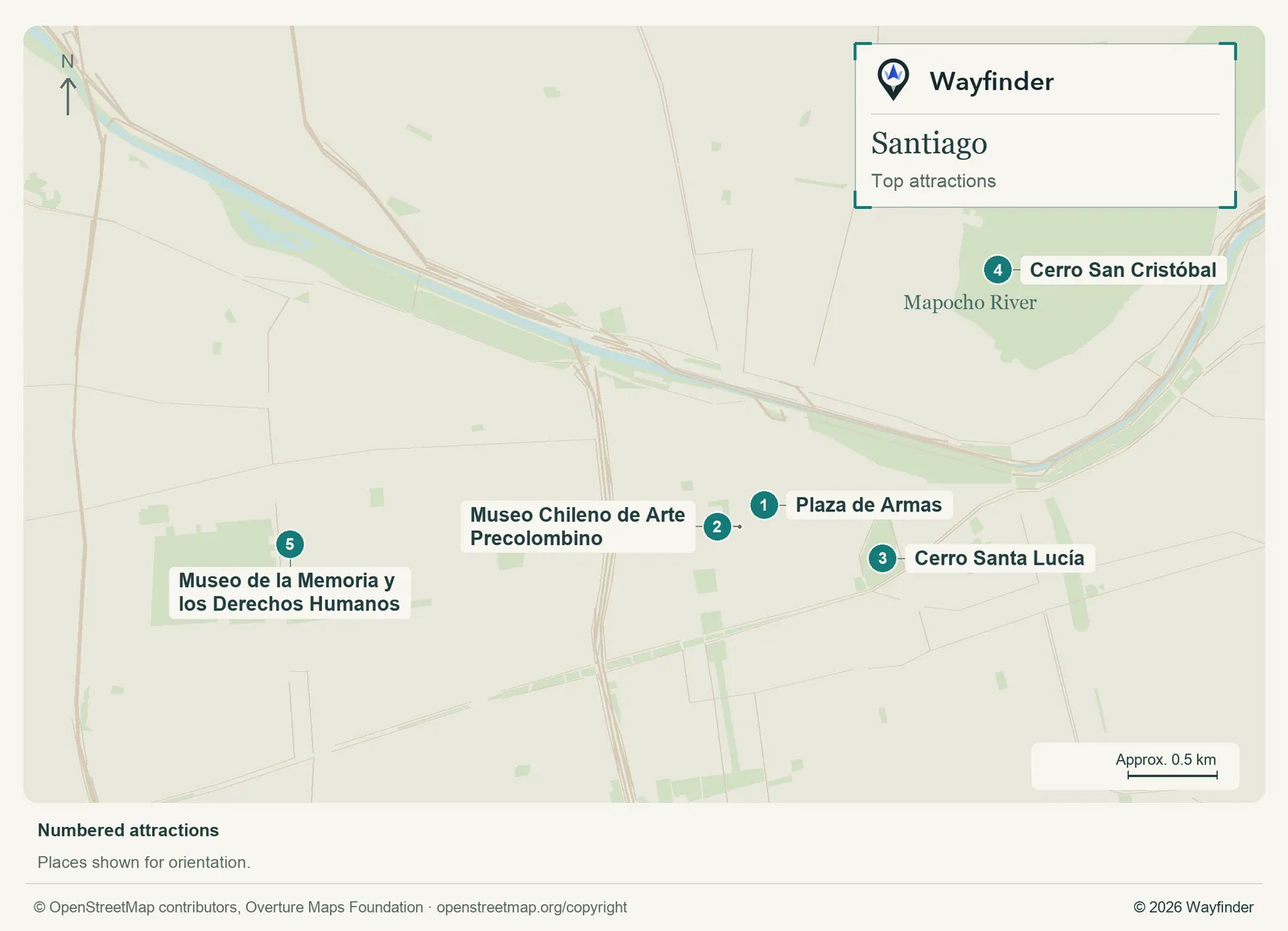
Map: Wayfinder. Map data © OpenStreetMap contributors, Overture Maps Foundation (OpenStreetMap copyright, Overture attribution).
Open attractions map (SVG, full detail)

- Plaza de Armas. Start in daytime and use the square to reach the adjoining historic buildings before heading farther (Santiago visitor information, checked November 20, 2026)
- Museo Chileno de Arte Precolombino. Give this a proper visit and pick a few collections rather than rushing through before the next stop (Santiago visitor information, checked November 20, 2026)
- Cerro Santa Lucía. Check access gates and choose the amount of climbing that suits you. Pair it with lunch nearby (Santiago visitor information, checked November 20, 2026)
- Cerro San Cristóbal. Check which park entrance and uphill service fit the time you have, and decide how to come back down (Santiago visitor information, checked November 20, 2026)
- Museo de la Memoria y los Derechos Humanos. Visit independently, with time to engage with the exhibition and a quiet break afterward (Museo de la Memoria y los Derechos Humanos, checked November 20, 2026)
Where to stay
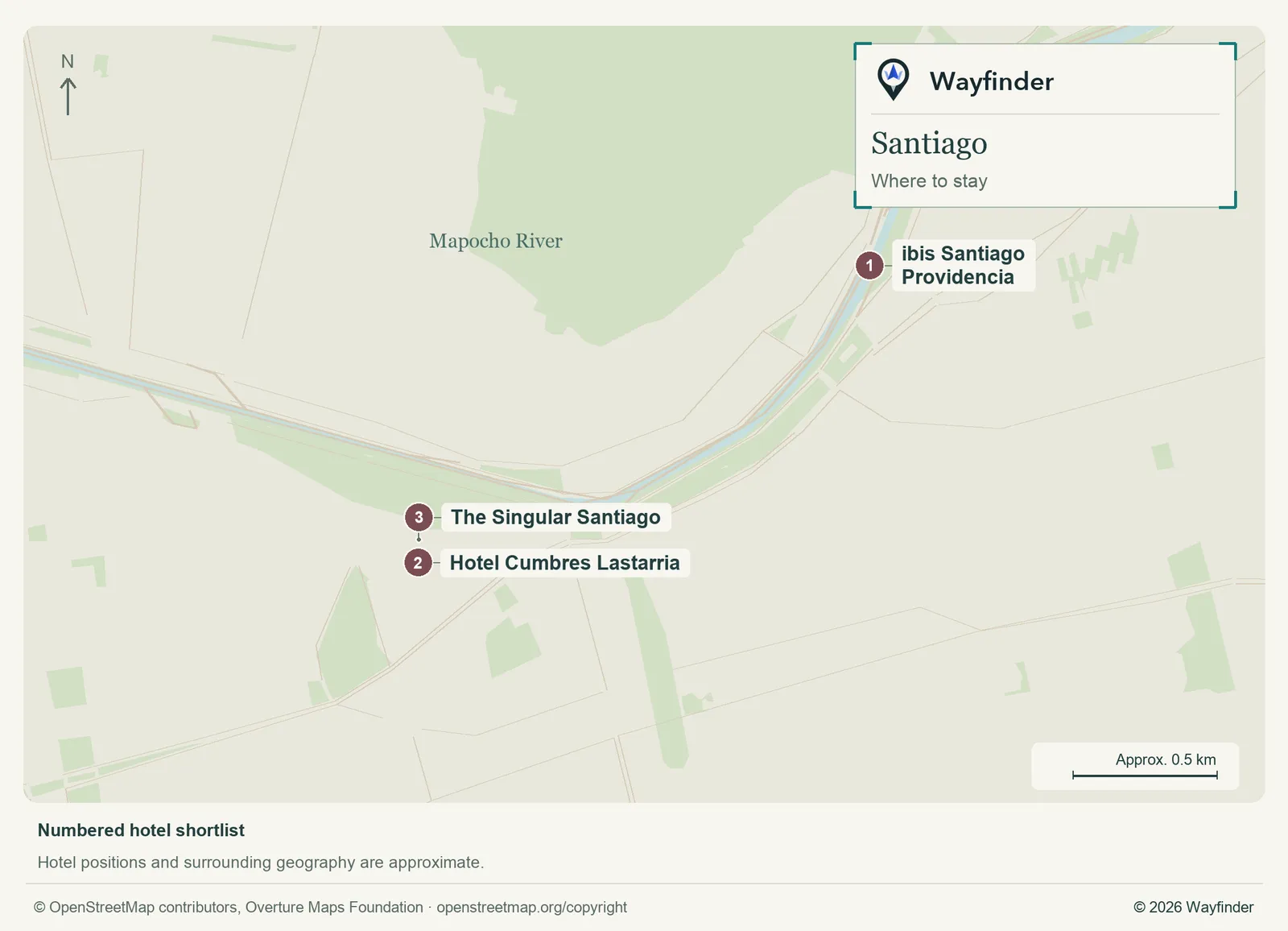
Map: Wayfinder. Map data © OpenStreetMap contributors, Overture Maps Foundation (OpenStreetMap copyright, Overture attribution).
Open hotels map (SVG, full detail)

- ibis Santiago Providencia (Providencia, value starting point). Choose Providencia for everyday services and access toward the east as well as the centre (ibis Santiago Providencia, checked November 20, 2026)
- Hotel Cumbres Lastarria (Lastarria, midrange candidate). Choose Lastarria for evenings within walking distance of cultural venues and parks (Hotel Cumbres Lastarria, checked November 20, 2026)
- The Singular Santiago (Lastarria, splurge). Stay here for a walkable arts district and set aside separate transport for anything outside the central cluster (The Singular Santiago, checked November 20, 2026)
Getting in and around
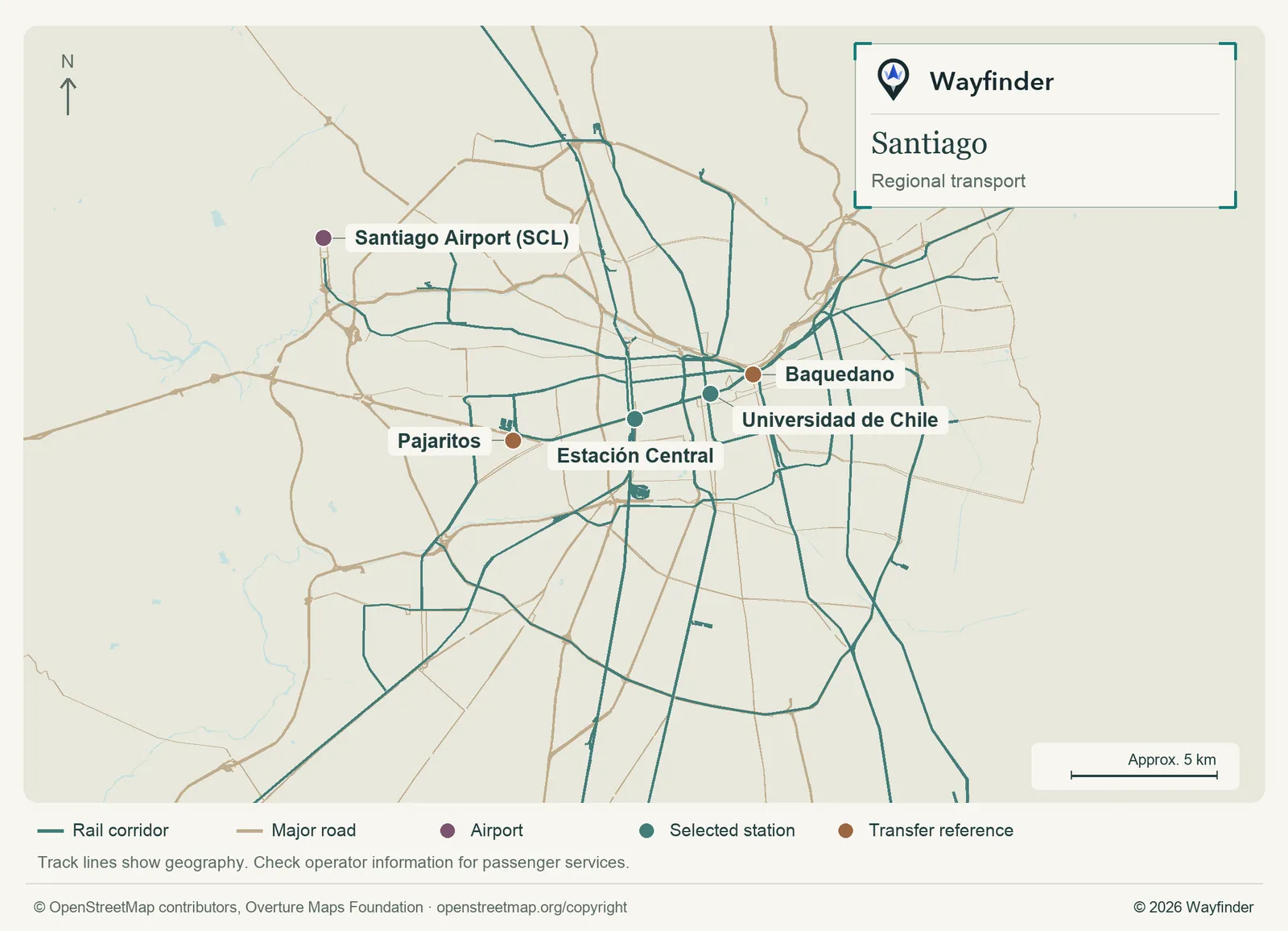
Map: Wayfinder. Map data © OpenStreetMap contributors, Overture Maps Foundation (OpenStreetMap copyright, Overture attribution).
Open regional transport map (SVG, full detail)

Compare airport coaches and approved ground transport and check the stop where you need to change. Use the Metro for longer city trips. Rail departures use facilities around Estación Central. If heading into a hill park, check its return options off the city grid and leave enough time to get down in daylight. (Airport or regional connections, checked November 20, 2026) (Local transport information, checked November 20, 2026)
How to use three days
Use day one for Plaza de Armas and one museum. Spend day two on a clear-weather hill outing and have dinner near your hotel. On day three, visit the memory museum or arrange a separate excursion outside Santiago with a reliable onward connection.
If you only have a day
Put the pre-Columbian museum and the central square together. Use any clear afternoon for Santa Lucía or switch to a longer museum visit if the hill route is closed or the weather isn’t good.
Common questions
Can I use one day for both hills and the main museums?
Choose one hill and one nearby museum. If you have a specific exhibition in mind, give it the longer block and keep the second hill optional.
Which area suits a one-night stop?
Choose a base around the arrival and departure that matter. Lastarria suits central evening plans if your transport leaves enough time to use them.
More on Wayfinder
Sources
- Santiago visitor information, checked November 20, 2026.
- Museo de la Memoria y los Derechos Humanos, checked November 20, 2026.
- ibis Santiago Providencia, checked November 20, 2026.
- Hotel Cumbres Lastarria, checked November 20, 2026.
- The Singular Santiago, checked November 20, 2026.
- Airport or regional connections, checked November 20, 2026.
- Local transport information, checked November 20, 2026.