Rio de Janeiro visitor guide
Use clear weather for Rio’s viewpoints, group the coastal visits and compare the two airport approaches.

Give Rio clear-weather slots for viewpoints and separate time for the beaches. Choose a hotel for the stretch of coast or evening area you will use most. Put the centre and Santa Teresa on their own itinerary so the visit can keep its pace.
What to see
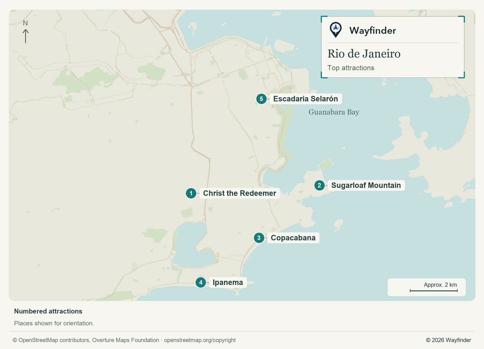
Map: Wayfinder. Map data © OpenStreetMap contributors, Overture Maps Foundation (OpenStreetMap copyright, Overture attribution).
Open attractions map (SVG, full detail)

- Christ the Redeemer. Check visibility and the official access options. Allow time for the transport to the summit as part of the visit. (Riotur Corcovado, checked November 20, 2026)
- Sugarloaf Mountain. Choose a clear slot and check the cable-car arrangements and departure point. (Rio de Janeiro visitor information, checked November 20, 2026)
- Copacabana. Use one section of the waterfront rather than walking the length by default. (Rio de Janeiro visitor information, checked November 20, 2026)
- Ipanema. Pick a beach or dining stretch and give the neighborhood separate time. (Rio de Janeiro visitor information, checked November 20, 2026)
- Escadaria Selarón. Use a short centre-area outing for the steps and choose the approach and return independently. (Visit Santa Teresa, checked November 20, 2026)
Where to stay
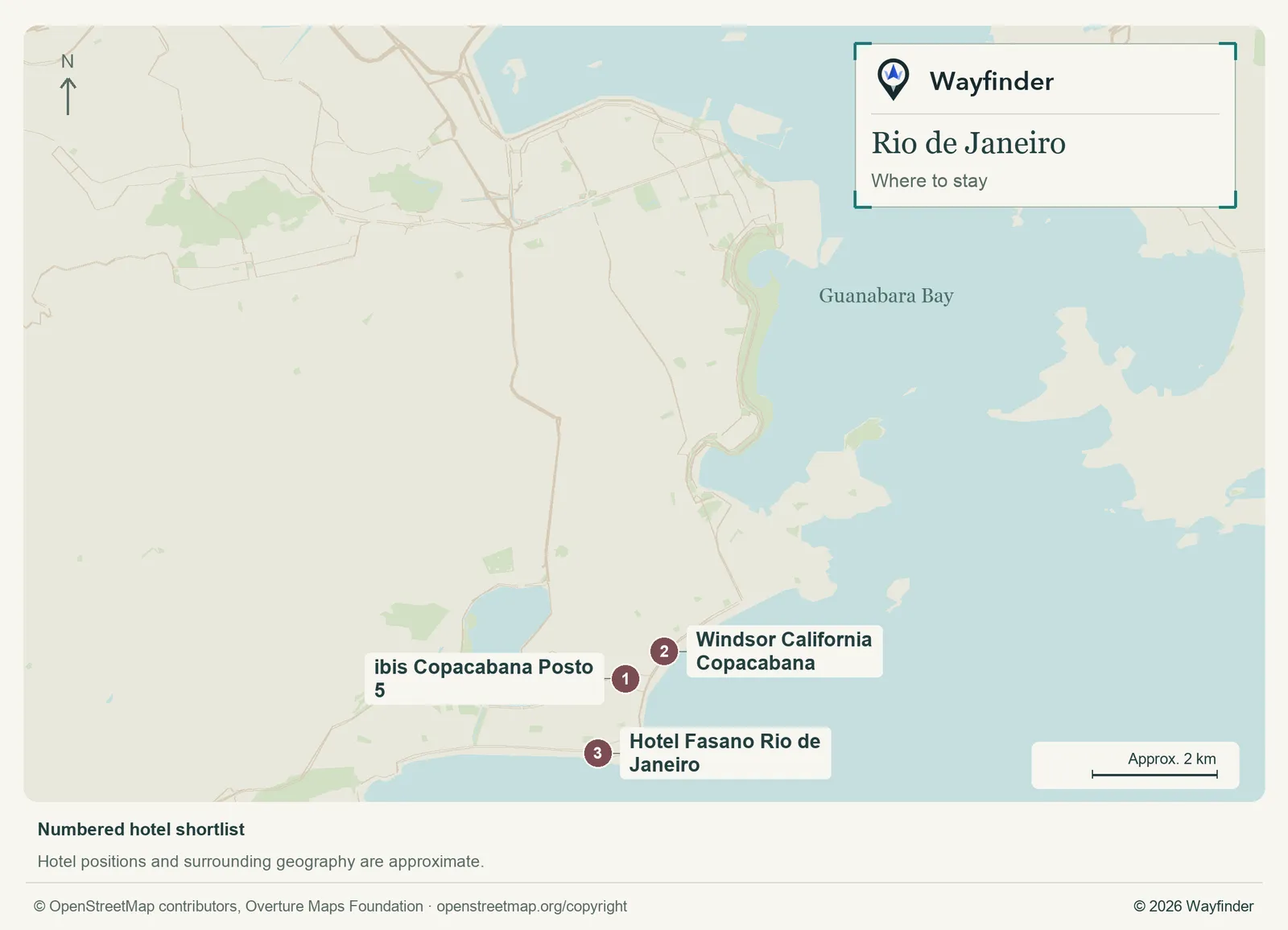
Map: Wayfinder. Map data © OpenStreetMap contributors, Overture Maps Foundation (OpenStreetMap copyright, Overture attribution).
Open hotels map (SVG, full detail)

- ibis Copacabana Posto 5 (Copacabana, value starting point). Choose a value-oriented Copacabana base when you want the neighborhood near most evenings. (ibis Copacabana Posto 5, checked November 20, 2026)
- Windsor California Copacabana (Copacabana waterfront, midrange candidate). Choose the seafront if it helps you spend time on the beach between larger outings. (Windsor California Copacabana, checked November 20, 2026)
- Hotel Fasano Rio de Janeiro (Ipanema, splurge). Ipanema works for a splurge when beach time and the surrounding streets are priorities. (Hotel Fasano Rio de Janeiro, checked November 20, 2026)
Getting in and around
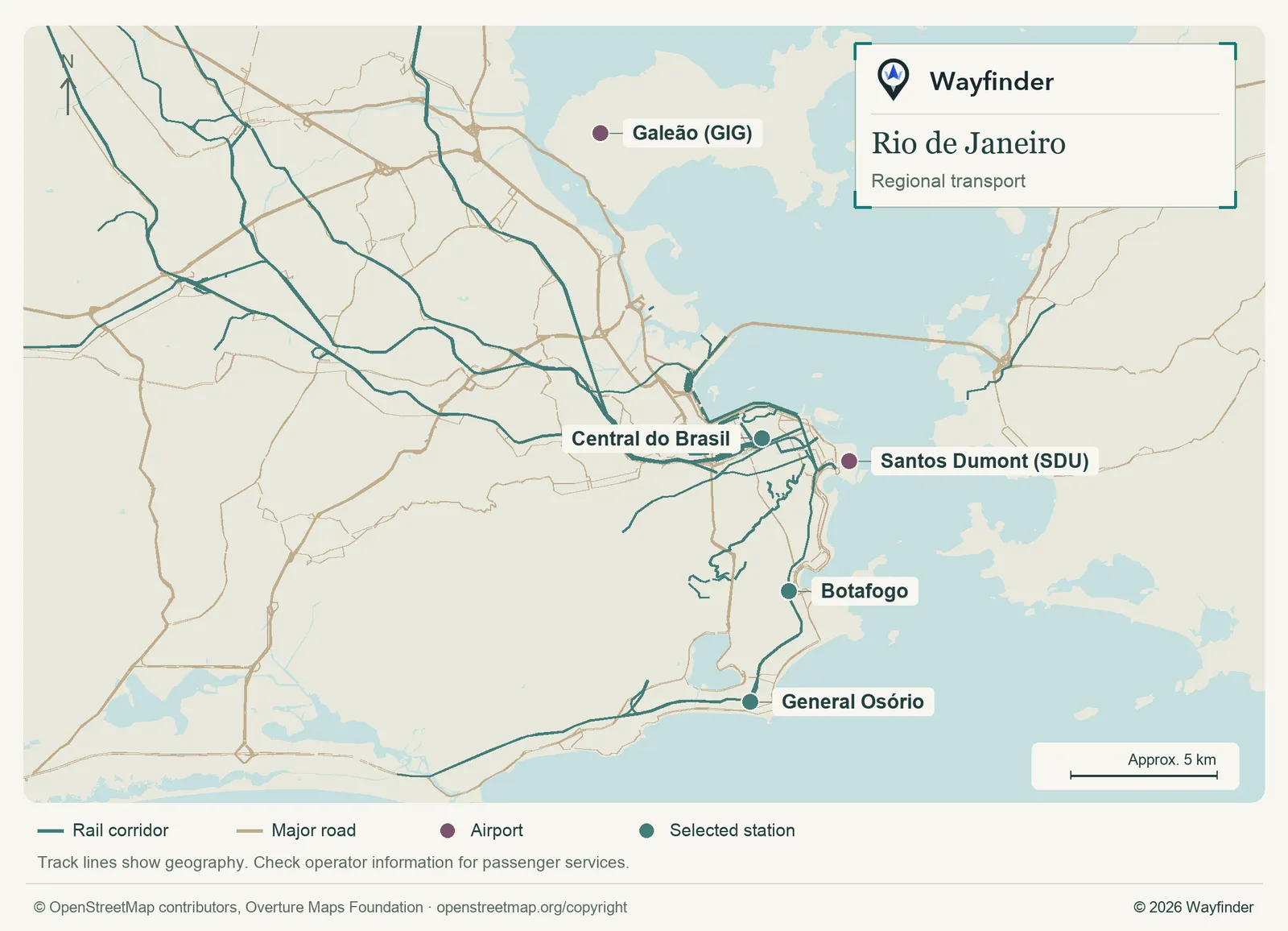
Map: Wayfinder. Map data © OpenStreetMap contributors, Overture Maps Foundation (OpenStreetMap copyright, Overture attribution).
Open regional transport map (SVG, full detail)

Check your airport code. Use the airport operator’s live ground information and compare the final hotel leg before choosing a bus or car. Metro is useful along some coastal and central corridors. Use the current planner for a separately arranged iconic sight. (Airport or regional connections, checked November 20, 2026) (Local transport information, checked November 20, 2026)
How to use three days
Use one clear slot for Corcovado or Sugarloaf and leave the next half-day for the beach. Give the centre a day of its own, then choose a second viewpoint or more coast on the third. Move the hard-to-see viewpoint first when the forecast shifts.
If you only have a day
For one day, combine one viewpoint and one waterfront stretch. If visibility is poor, go to your beach-side or centre outing first and recheck later. A second viewpoint makes sense only if you have the travel time and conditions for it.
Common questions
Should I book both viewpoints on the same day?
Give yourself the option to change one. A second day can bring better visibility and a more comfortable pace.
What if visibility stays poor?
Give a beach neighborhood or the center the longest outing and make just one viewpoint optional. Check the specific access operator before leaving the hotel. A little flexibility saves a long detour when the view is the reason for the visit.
Sources
- Rio de Janeiro visitor information, checked November 20, 2026.
- Riotur Corcovado, checked November 20, 2026.
- Visit Santa Teresa, checked November 20, 2026.
- ibis Copacabana Posto 5, checked November 20, 2026.
- Windsor California Copacabana, checked November 20, 2026.
- Hotel Fasano Rio de Janeiro, checked November 20, 2026.
- Airport or regional connections, checked November 20, 2026.
- Local transport information, checked November 20, 2026.