Oxford visitor guide
For Oxford, pick one college or library interior before building the rest of the day around museums and lanes.

Colleges set their own visitor arrangements and may close around university business. Use Beaumont Street as a second centre when the historic heart is busy, and roll the remaining indoor stops into a wet-weather plan.
What to see
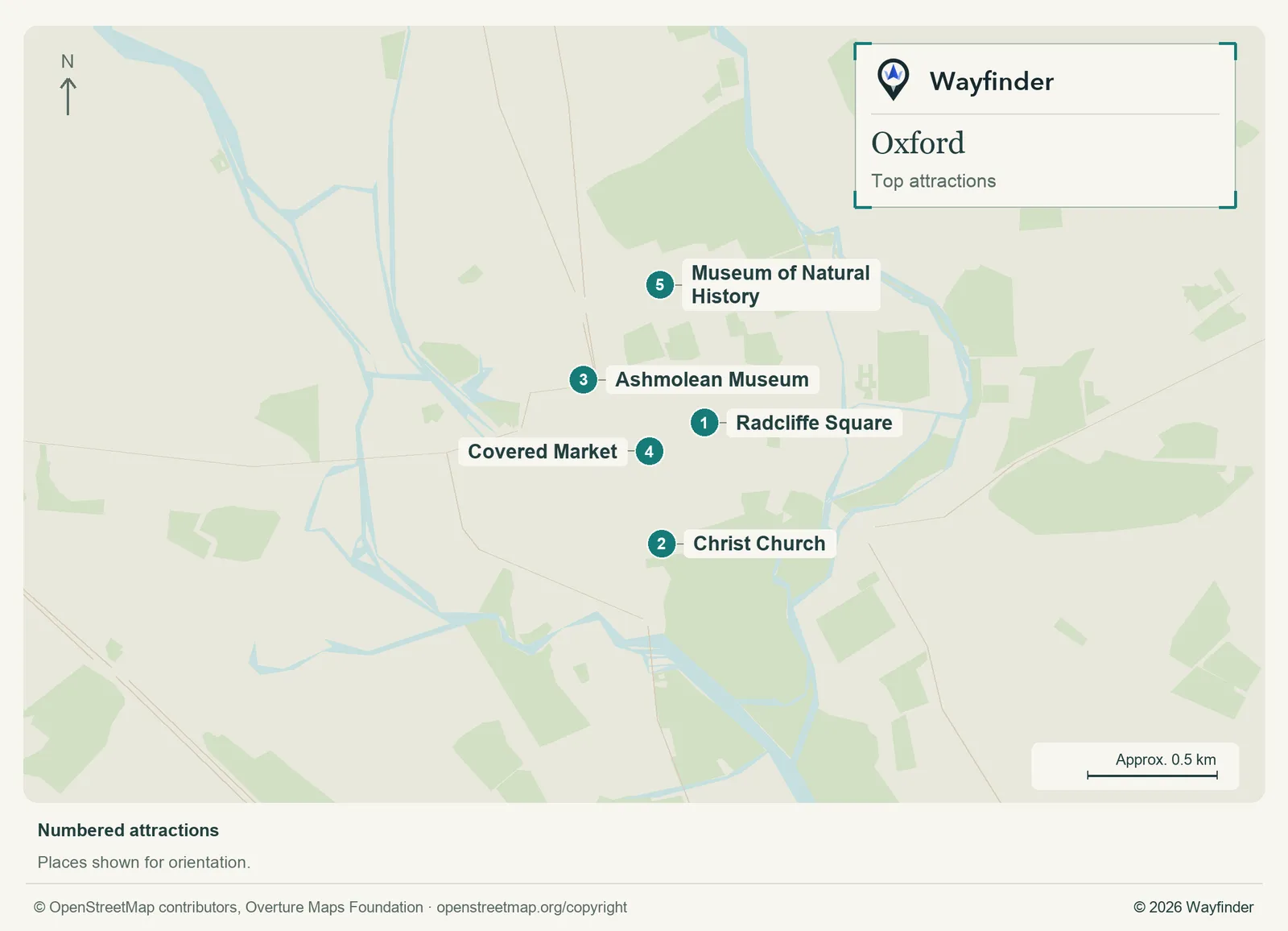
Map: Wayfinder. Map data © OpenStreetMap contributors, Overture Maps Foundation (OpenStreetMap copyright, Overture attribution).
Open attractions map (SVG, full detail)

- Radcliffe Square. Start outside for the view of the Radcliffe Camera and nearby colleges. Check the Bodleian’s own tours for access inside (Bodleian Libraries, checked November 20, 2026)
- Christ Church. Allow time for the booked visit, then walk the meadow route if paths and gates are open (Oxford visitor information, checked November 20, 2026)
- Ashmolean Museum. Pick two galleries or one exhibition. Its location makes it a useful independent half-day (Oxford visitor information, checked November 20, 2026)
- Covered Market. Use it for a food stop between the High Street and Cornmarket rather than crossing town for lunch (Oxford visitor information, checked November 20, 2026)
- Museum of Natural History. Pair it with the neighbouring Pitt Rivers Museum and check their individual opening calendars (Oxford University Museum of Natural History, checked November 20, 2026)
Where to stay
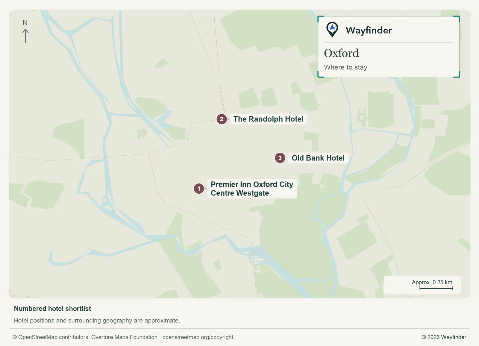
Map: Wayfinder. Map data © OpenStreetMap contributors, Overture Maps Foundation (OpenStreetMap copyright, Overture attribution).
Open hotels map (SVG, full detail)

- Premier Inn Oxford City Centre Westgate (Westgate, value starting point). This suits shopping, quick meals and a mostly flat walk through the centre (Premier Inn Oxford City Centre Westgate, checked November 20, 2026)
- The Randolph Hotel (Beaumont Street, midrange candidate). Stay here to put the Ashmolean on your doorstep and keep the railway station within practical reach (The Randolph Hotel, checked November 20, 2026)
- Old Bank Hotel (High Street, splurge). Choose the High Street to be near Christ Church and the historic lanes. Ask about luggage drop-off if driving (Old Bank Hotel, checked November 20, 2026)
Getting in and around
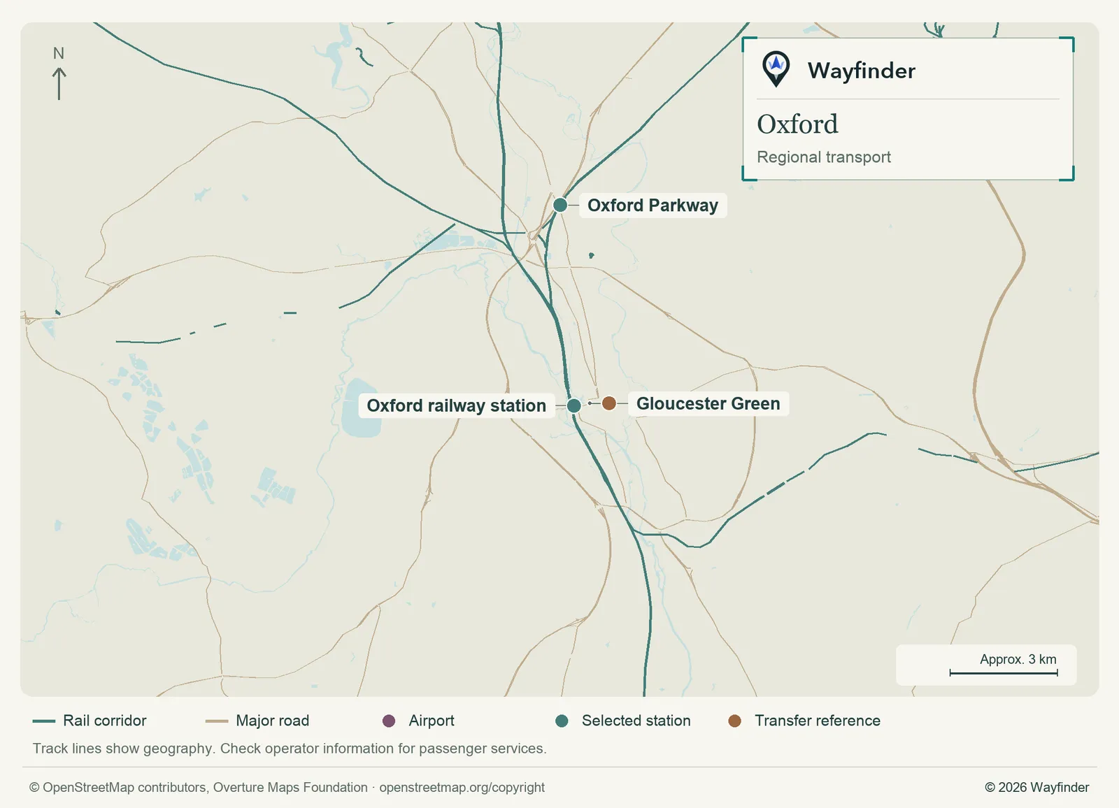
Map: Wayfinder. Map data © OpenStreetMap contributors, Overture Maps Foundation (OpenStreetMap copyright, Overture attribution).
Open regional transport map (SVG, full detail)

Oxford’s main railway station is west of the centre. Airport and longer-distance coaches use designated city stops such as Gloucester Green, depending on the service. Match the exact terminal and stop to your ticket. The main sights are walkable. A park-and-ride can be simpler than taking a car into the narrow central streets. (Airport or regional connections, checked November 20, 2026) (Local transport information, checked November 20, 2026)
How to use three days
Use day one for the college or library visit and the market. Give day two to the Ashmolean and the northern museums. On day three, walk the meadow or take a local bus out of Oxford for a single excursion with a known return plan.
If you only have a day
Choose a Bodleian or Christ Church visit, eat at or near the Covered Market, then leave the afternoon for an Ashmolean gallery and a walk back through the older streets.
Common questions
Can I just walk into the colleges?
Check each college’s visitor arrangements. Book the one interior you most want to see and leave time for public streets, squares and museums around it.
Can I visit while my bags are with me?
Check the venue’s bag policy and arrange storage before any timed interior. The station and centre aren’t the same location.
More on Wayfinder
- Go inside Oxford’s Bodleian on a library tour from Bucketlist
Sources
- Oxford visitor information, checked November 20, 2026.
- Bodleian Libraries, checked November 20, 2026.
- Oxford University Museum of Natural History, checked November 20, 2026.
- Premier Inn Oxford City Centre Westgate, checked November 20, 2026.
- The Randolph Hotel, checked November 20, 2026.
- Old Bank Hotel, checked November 20, 2026.
- Airport or regional connections, checked November 20, 2026.
- Local transport information, checked November 20, 2026.