Oslo visitor guide
Group Oslo’s waterfront and major art museums, with simple options for trains and the Vigeland outing.

Oslo rewards a harbor-centred first day and a separate outing for either art or parks. Bjørvika is useful if you arrive by train, while areas farther west give you a different evening address. Let weather determine whether the next free half-day is indoors or on foot.
What to see
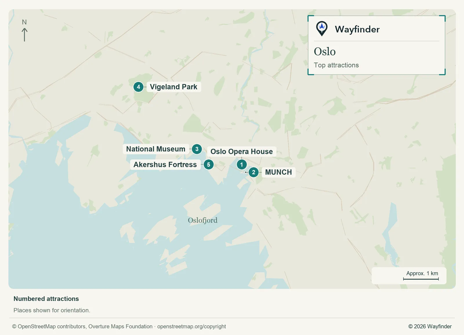
Map: Wayfinder. Map data © OpenStreetMap contributors, Overture Maps Foundation (OpenStreetMap copyright, Overture attribution).
Open attractions map (SVG, full detail)

- Oslo Opera House. Start outside at the harbor. Check access and conditions if you intend to go onto the roof. (Oslo visitor information, checked November 19, 2026)
- MUNCH. Choose a collection or exhibition and leave room for Bjørvika afterward. (Oslo visitor information, checked November 19, 2026)
- National Museum. Use it as a stand-alone art visit and build the harbor walk around the time you want indoors. (Oslo visitor information, checked November 19, 2026)
- Vigeland Park. Give the outdoor sculpture route its own part of the day. Choose a limited section if time or weather is tight. (Oslo visitor information, checked November 19, 2026)
- Akershus Fortress. Explore the setting and views, checking opening arrangements for any specific building. (Norwegian Defence Estates, checked November 20, 2026)
Where to stay
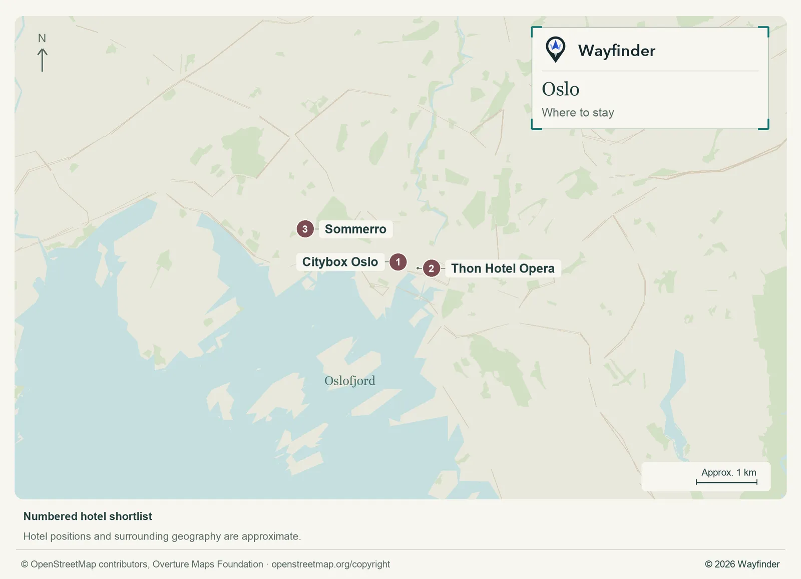
Map: Wayfinder. Map data © OpenStreetMap contributors, Overture Maps Foundation (OpenStreetMap copyright, Overture attribution).
Open hotels map (SVG, full detail)

- Citybox Oslo (Station district, value starting point). Citybox is useful for a simple, station-side room when arrival effort matters. (Citybox Oslo, checked November 20, 2026)
- Thon Hotel Opera (Bjørvika, midrange candidate). Choose the Opera area if the train and the new harbor district will both shape your days. (Thon Hotel Opera, checked November 20, 2026)
- Sommerro (Frogner edge, splurge). Stay farther west for neighborhood evenings and time in the hotel, with a separate transit trip to Bjørvika. (Sommerro, checked November 20, 2026)
Getting in and around
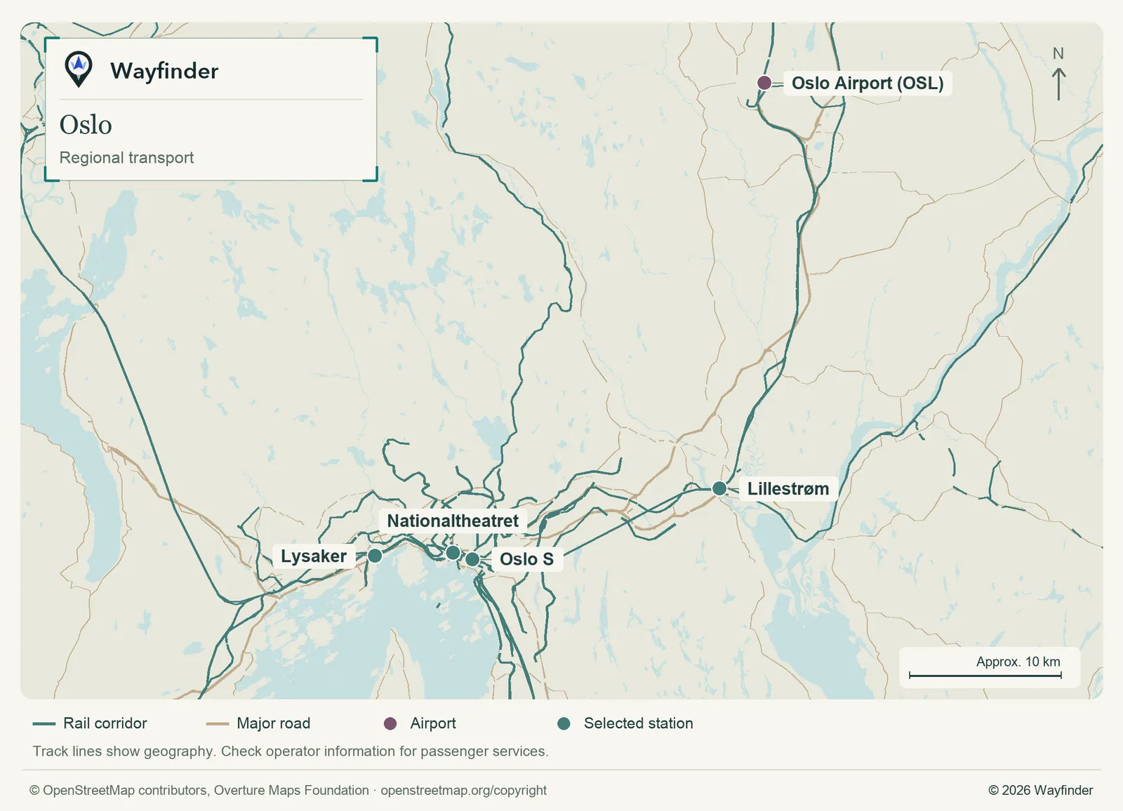
Map: Wayfinder. Map data © OpenStreetMap contributors, Overture Maps Foundation (OpenStreetMap copyright, Overture attribution).
Open regional transport map (SVG, full detail)

At Oslo Airport, compare the rail services and tickets for Oslo S or a station closer to your accommodation. Check which operator’s ticket you are buying. Use Ruter for local travel, including trips to the sculpture park or along the waterfront. (Airport or regional connections, checked November 20, 2026) (Local transport information, checked November 20, 2026)
How to use three days
Give Bjørvika and the Opera House the first day. Pick the National Museum or MUNCH as the next major art visit, then use the other free block for Akershus. Put the sculpture park into a clear-weather window and leave room for the tram ride and an evening meal.
If you only have a day
If you have one day, spend it around the harbor and choose either MUNCH or the National Museum. Head for Vigeland instead if the parks are what you came to see and the weather suits it. Keep the station approach simple if you leave that evening.
Common questions
Is Oslo S the only practical arrival station?
Compare the available trains with your hotel address. Nationaltheatret can be the more useful stop for certain western-centre bases.
Is the harbor also the best place to start a museum day?
Start in Bjørvika for MUNCH or the Opera House area. For the National Museum, use its own western harbor approach. If the weather is poor, make one museum the longest visit and leave the outdoor connection for later.
More on Wayfinder
- Watch Oslo celebrate Norway’s Constitution Day from Bucketlist
Sources
- Oslo visitor information, checked November 19, 2026.
- Norwegian Defence Estates, checked November 20, 2026.
- Citybox Oslo, checked November 20, 2026.
- Thon Hotel Opera, checked November 20, 2026.
- Sommerro, checked November 20, 2026.
- Airport or regional connections, checked November 20, 2026.
- Local transport information, checked November 20, 2026.