Glasgow visitor guide
Glasgow works best in two clusters: the central streets around the two main stations and the West End around Kelvingrove.

Give each its own half-day and remember the riverside museums are a separate move. If the weather is good, use the green space near the university to slow down between indoor stops.
What to see
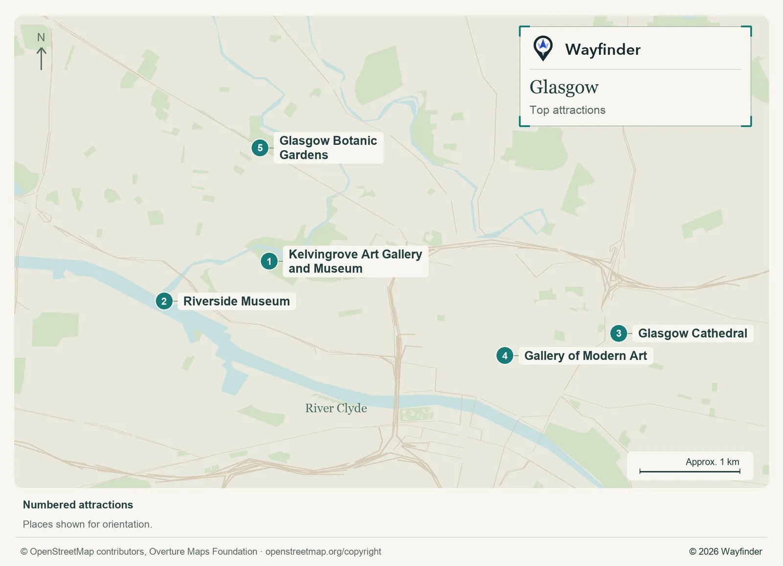
Map: Wayfinder. Map data © OpenStreetMap contributors, Overture Maps Foundation (OpenStreetMap copyright, Overture attribution).
Open attractions map (SVG, full detail)

- Kelvingrove Art Gallery and Museum. Choose a couple of rooms and pair the museum with Kelvingrove Park or the university hillside (Glasgow Life, checked November 20, 2026)
- Riverside Museum. Dedicate a trip to the transport collection and check access to the ship beside the museum (Glasgow visitor information, checked November 20, 2026)
- Glasgow Cathedral. Start here for older Glasgow and leave time for the Necropolis if you’re comfortable with its slopes (Glasgow visitor information, checked November 20, 2026)
- Gallery of Modern Art. Make this the indoor stop on a city-centre walk around Royal Exchange Square (Glasgow visitor information, checked November 20, 2026)
- Glasgow Botanic Gardens. Use the gardens as the northern end of a Byres Road visit, with a break for lunch before returning (Friends of Glasgow Botanic Gardens, checked November 20, 2026)
Where to stay
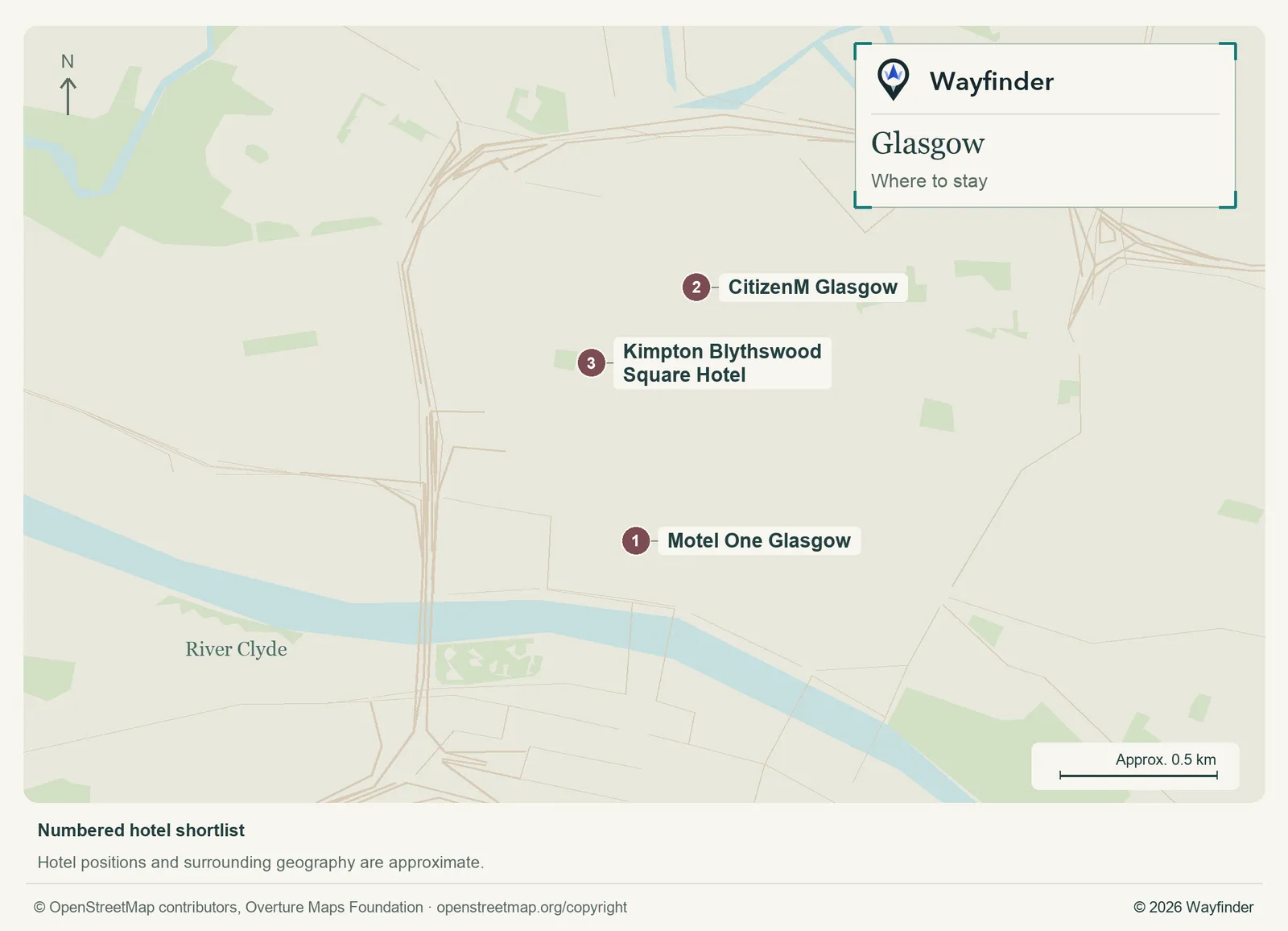
Map: Wayfinder. Map data © OpenStreetMap contributors, Overture Maps Foundation (OpenStreetMap copyright, Overture attribution).
Open hotels map (SVG, full detail)

- Motel One Glasgow (Central station, value starting point). Stay here when Central serves your train or you want a simple start from the south side of the centre (Motel One Glasgow, checked November 20, 2026)
- CitizenM Glasgow (Theatre district, midrange candidate). Choose this for shows, Queen Street arrivals and an easy walk to city-centre museums (CitizenM Glasgow, checked November 20, 2026)
- Kimpton Blythswood Square Hotel (Blythswood Hill, splurge). Stay on the hill for a quieter square. Account for the uphill return if walking back at night (Kimpton Blythswood Square Hotel, checked November 20, 2026)
Getting in and around
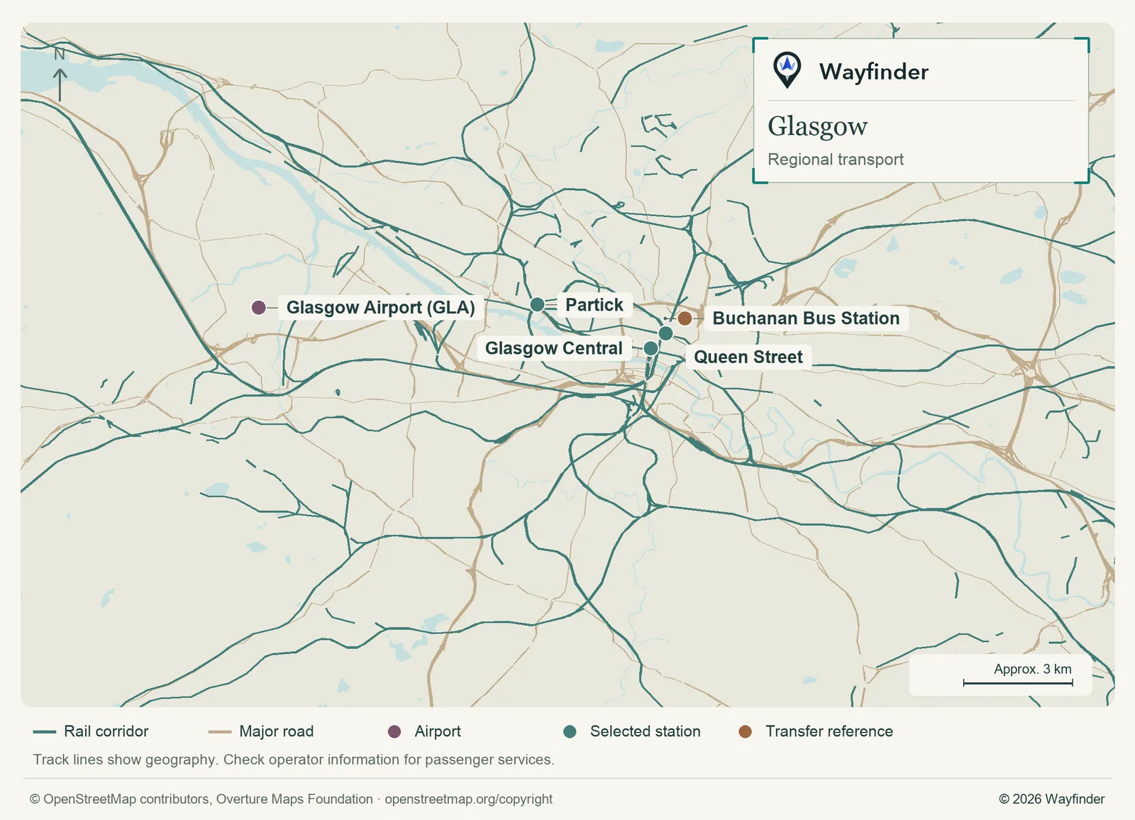
Map: Wayfinder. Map data © OpenStreetMap contributors, Overture Maps Foundation (OpenStreetMap copyright, Overture attribution).
Open regional transport map (SVG, full detail)

The airport bus is a natural first check for a city-centre stay. If rail is part of the airport journey, check the road transfer to the station separately. Central and Queen Street handle different services, so look at your exact ticket. The Subway is useful for linking the centre and west, with buses or walking for places beyond its loop. (Airport or regional connections, checked November 20, 2026) (Local transport information, checked November 20, 2026)
How to use three days
Spend day one around the central galleries and cathedral. On day two, use Kelvingrove and the university area as one outing. Keep day three for Riverside and the Clyde, then return to whichever neighbourhood you wanted more time in.
If you only have a day
Choose the cathedral and one central gallery if you’re arriving by rail. Alternatively spend almost the whole day around Kelvingrove, the park and a West End meal.
Common questions
Do I need the Subway for the museums?
It helps on the west side, depending on the stops. Compare the walking distance from Partick or Kelvinhall for the exact museum entrance.
What makes a useful wet-weather plan?
Pick one museum with more than you expect to see and keep the walk to lunch short. Kelvingrove and the Riverside are separate sites.
More on Wayfinder
- Glasgow place profile from Bucketlist
Sources
- Glasgow visitor information, checked November 20, 2026.
- Glasgow Life, checked November 20, 2026.
- Friends of Glasgow Botanic Gardens, checked November 20, 2026.
- Motel One Glasgow, checked November 20, 2026.
- CitizenM Glasgow, checked November 20, 2026.
- Kimpton Blythswood Square Hotel, checked November 20, 2026.
- Airport or regional connections, checked November 20, 2026.
- Local transport information, checked November 20, 2026.