Geneva visitor guide
Geneva is easiest to think of by shores and hills.

Spend your first walk by the lake and along the lower river, then save enough time for the steep streets of the old town. Choose either international institutions or museums as the next big outing and book ahead for the particular tour you want.
What to see
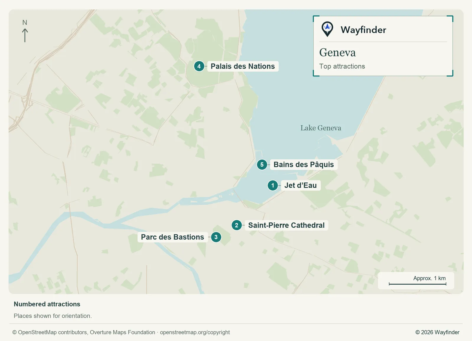
Map: Wayfinder. Map data © OpenStreetMap contributors, Overture Maps Foundation (OpenStreetMap copyright, Overture attribution).
Open attractions map (SVG, full detail)

- Jet d’Eau. View it from the shore when operating. Walk farther only if the wind and access work for your group (Geneva Tourism on the Jet d’Eau, checked November 20, 2026)
- Saint-Pierre Cathedral. Make this the old-town anchor and check tower access before planning around the view (Geneva visitor information, checked November 20, 2026)
- Parc des Bastions. Use the park as an easy way to end the hill walk. Look for the Reformation Wall along its edge (Geneva visitor information, checked November 20, 2026)
- Palais des Nations. Make a separate booking if you want a tour and verify the security entrance and documents (Geneva visitor information, checked November 20, 2026)
- Bains des Pâquis. Choose this for a waterfront break. Check the current activities, public access and weather before setting out (Bains des Pâquis visitor information, checked November 20, 2026)
Where to stay
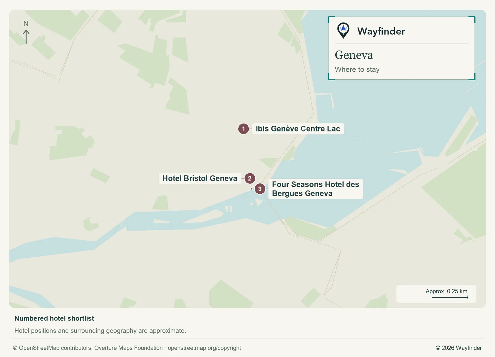
Map: Wayfinder. Map data © OpenStreetMap contributors, Overture Maps Foundation (OpenStreetMap copyright, Overture attribution).
Open hotels map (SVG, full detail)

- ibis Genève Centre Lac (Pâquis, value starting point). Choose Pâquis for meals, lake access and a practical walk from Cornavin (ibis Genève Centre Lac, checked November 20, 2026)
- Hotel Bristol Geneva (Mont-Blanc, midrange candidate). Stay by the bridge to make both shores straightforward on foot (Hotel Bristol Geneva, checked November 20, 2026)
- Four Seasons Hotel des Bergues Geneva (Right-bank waterfront, splurge). Choose this historic riverfront hotel if the water and central evening walks are priorities (Four Seasons Hotel des Bergues Geneva, checked November 20, 2026)
Getting in and around
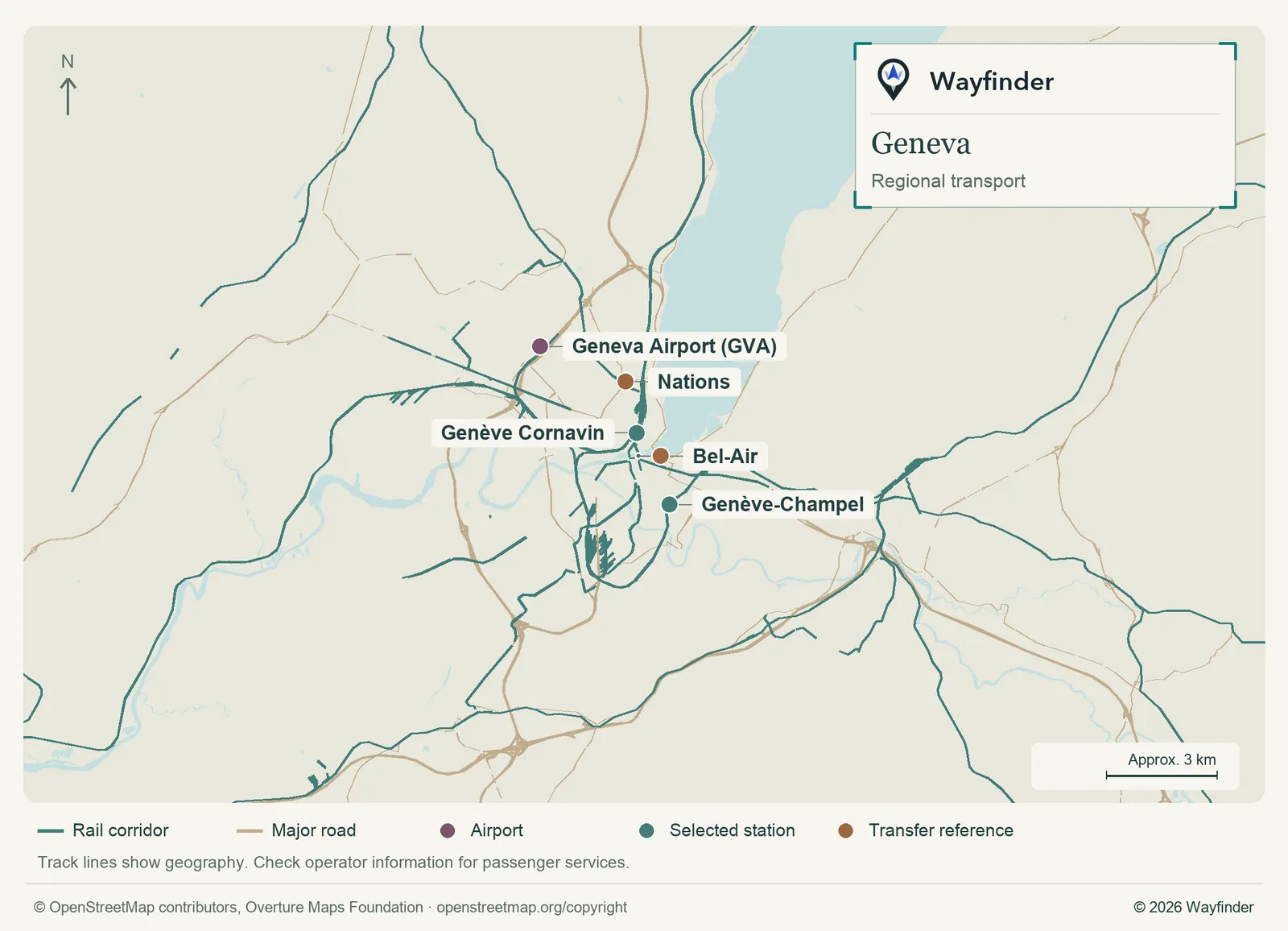
Map: Wayfinder. Map data © OpenStreetMap contributors, Overture Maps Foundation (OpenStreetMap copyright, Overture attribution).
Open regional transport map (SVG, full detail)

Compare the airport rail ride to Cornavin with any bus that takes you closer to the hotel. The city’s tram and bus network can spare an uphill walk or simplify a trip to Nations. Small public passenger boats cross parts of the lakefront. Check the line and boarding point rather than assuming a route follows your walk exactly. (Airport or regional connections, checked November 20, 2026) (Local transport information, checked November 20, 2026)
How to use three days
Use day one for the lake and old town. Day two works for Nations and one nearby museum or park. On day three, stay by the lake, take a short boat outing or add a rail day trip after checking the return.
If you only have a day
Start near the water and take in the Jet d’Eau if operating. Spend the afternoon around Saint-Pierre and the Bastions, with a stop before the uphill walk if needed.
Common questions
Can I walk up to the United Nations for a tour?
Treat the visit as a booking. Use the tour provider’s current entry rules and allow enough time to reach the designated entrance.
Is a hotel near Cornavin a good choice?
It simplifies airport rail and regional trips. If waterfront walks matter most, compare the exact street distance to the lakeside.
More on Wayfinder
- Swiss Travel Pass vs Half Fare Card: how each works and how to compare them from Railway Reviews
Sources
- Geneva visitor information, checked November 20, 2026.
- Geneva Tourism on the Jet d’Eau, checked November 20, 2026.
- Bains des Pâquis visitor information, checked November 20, 2026.
- ibis Genève Centre Lac, checked November 20, 2026.
- Hotel Bristol Geneva, checked November 20, 2026.
- Four Seasons Hotel des Bergues Geneva, checked November 20, 2026.
- Airport or regional connections, checked November 20, 2026.
- Local transport information, checked November 20, 2026.