Brisbane visitor guide
Use Brisbane’s river to organise your stay.

The CBD and South Bank sit near each other across the water, with Fortitude Valley farther around the bend. Pick whether your evening ends near a museum, a restaurant district or a river walk, then stay on that side or choose the crossing first.
What to see
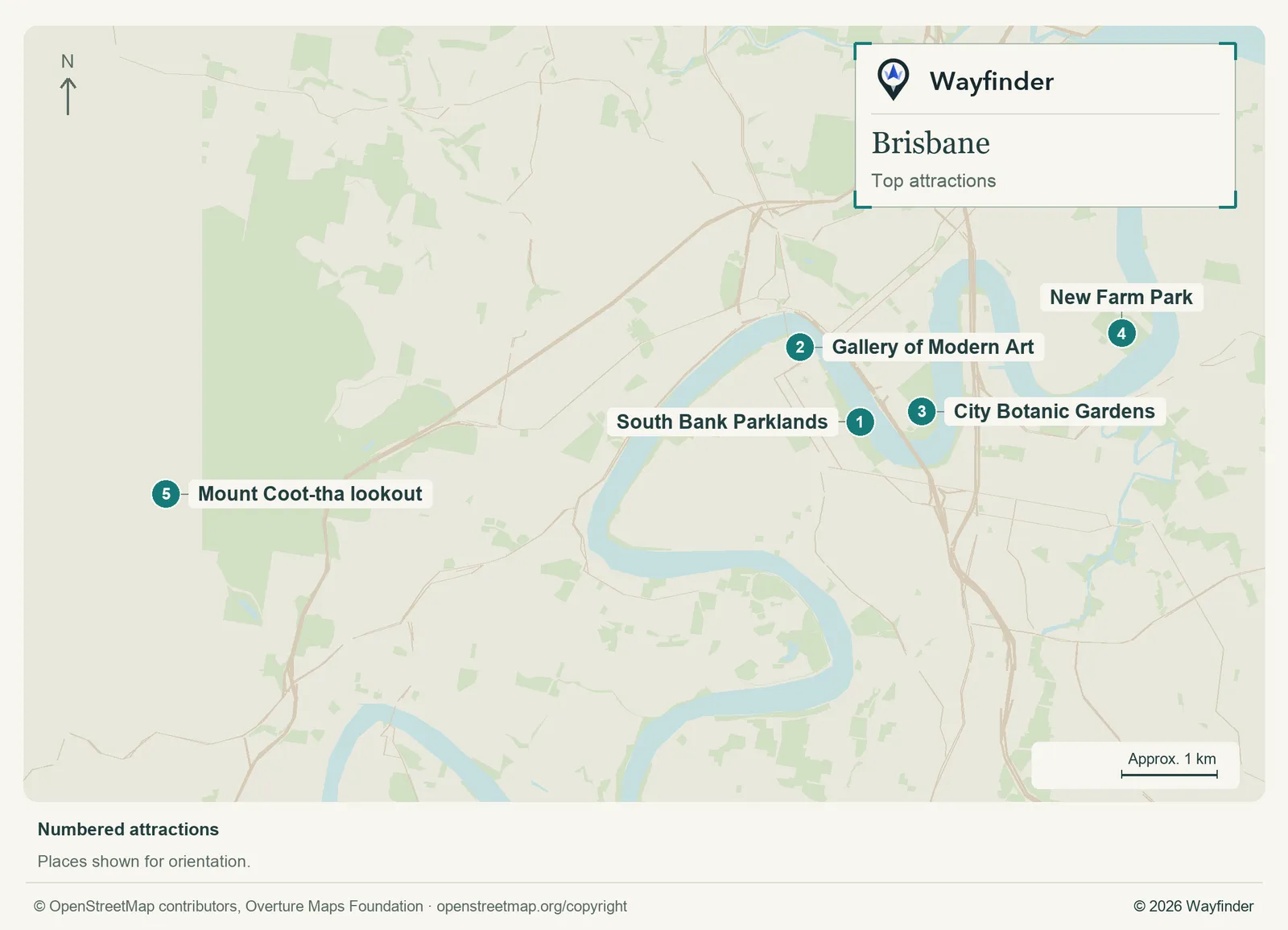
Map: Wayfinder. Map data © OpenStreetMap contributors, Overture Maps Foundation (OpenStreetMap copyright, Overture attribution).
Open attractions map (SVG, full detail)

- South Bank Parklands. Walk a portion of the riverfront and pick a food or shade stop before crossing back (South Bank Corporation, checked November 20, 2026)
- Gallery of Modern Art. Choose an exhibition and allow another block for neighbouring museums if that’s your reason for coming (Brisbane visitor information, checked November 20, 2026)
- City Botanic Gardens. Use the gardens to finish a CBD walk rather than trying to see both riverbanks in one hot afternoon (Brisbane visitor information, checked November 20, 2026)
- New Farm Park. Make the park and nearby Powerhouse a separate riverside outing with a planned ride back (Brisbane visitor information, checked November 20, 2026)
- Mount Coot-tha lookout. Check the transport and visibility before going uphill. Give it its own time away from river plans (Brisbane City Council, checked November 20, 2026)
Where to stay
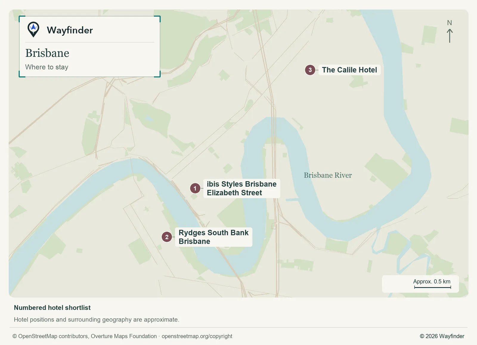
Map: Wayfinder. Map data © OpenStreetMap contributors, Overture Maps Foundation (OpenStreetMap copyright, Overture attribution).
Open hotels map (SVG, full detail)

- ibis Styles Brisbane Elizabeth Street (CBD, value starting point). Choose the CBD for transit, a walk to the gardens and several options for crossing to South Bank (ibis Styles Brisbane Elizabeth Street, checked November 20, 2026)
- Rydges South Bank Brisbane (South Bank, midrange candidate). Stay across the river for museum mornings and waterfront evenings. Check the easiest bridge or station approach (Rydges South Bank Brisbane, checked November 20, 2026)
- The Calile Hotel (Fortitude Valley, splurge). Choose this if restaurants and shops around James Street are the main plan for evenings (The Calile Hotel, checked November 20, 2026)
Getting in and around
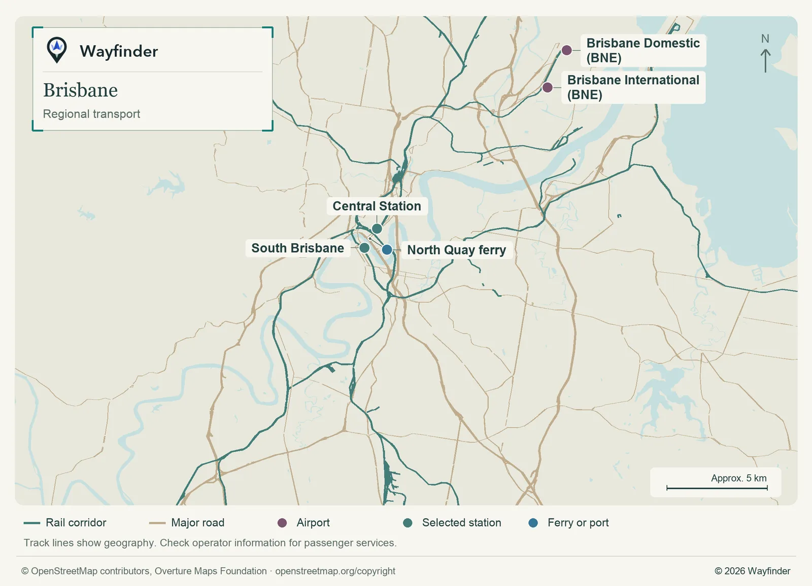
Map: Wayfinder. Map data © OpenStreetMap contributors, Overture Maps Foundation (OpenStreetMap copyright, Overture attribution).
Open regional transport map (SVG, full detail)

Compare Airtrain stops and operating times with a road ride. Board from the terminal on your ticket and check the South Brisbane or central city stop that fits. CityCat and other ferry services can make the river a trip in itself. Choose where to get off using the current route map, then walk from that side. (Airport or regional connections, checked November 20, 2026) (Local transport information, checked November 20, 2026)
How to use three days
Start with the CBD gardens and cross to South Bank. Day two works for the galleries and a meal in the Valley or on South Bank. On day three, choose New Farm and a ferry ride or take a separate trip to the Mount Coot-tha lookout.
If you only have a day
Start on a riverbank, cross once for South Bank and choose one gallery. Finish with a short ferry ride if service and weather suit.
Common questions
Can I use the river ferry as a sightseeing break?
Yes. Pick a few stops and a reliable return rather than committing to the entire route, especially when the weather is changing.
What’s the simplest museum area?
South Bank and the Cultural Centre put several venues close together. Check the closest rail or bus stop against your individual destination.
Sources
- Brisbane visitor information, checked November 20, 2026.
- South Bank Corporation, checked November 20, 2026.
- Brisbane City Council, checked November 20, 2026.
- ibis Styles Brisbane Elizabeth Street, checked November 20, 2026.
- Rydges South Bank Brisbane, checked November 20, 2026.
- The Calile Hotel, checked November 20, 2026.
- Airport or regional connections, checked November 20, 2026.
- Local transport information, checked November 20, 2026.